Revolutionizing the industry, 3D laser scanning has become one of the most efficient and accurate ways of conducting detailed as-built surveys of complex buildings. Because it provides reliable data during the planning phase of renovations, laser scanning is especially attractive. For our clients, we provide a three-step process of conducting surveys and transforming them into useful documentation that can aid in saving money and advancing successful projects.
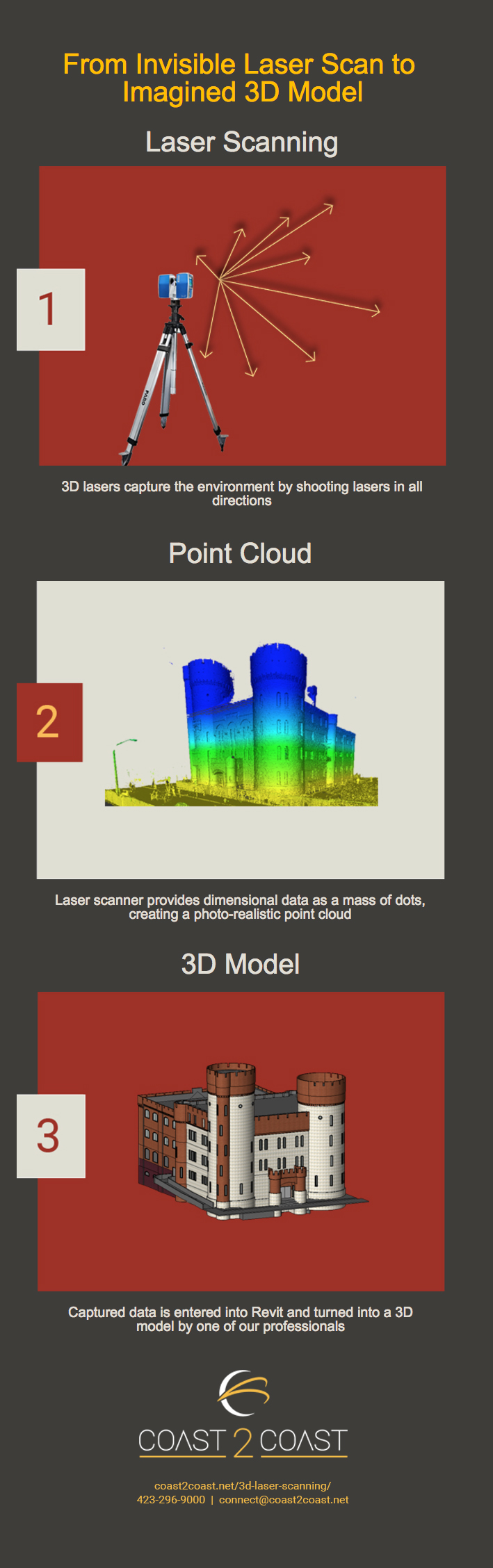
1. Laser Scanning: Digitize your Reality FAST
A single FARO laser scanner has the power to survey thousands of square feet per day. When scanning distances under 300 feet, the FARO laser scanner is more accurate and faster than other scanners and operates at a lower noise level.
When activated, a laser bounces off the scanner’s rotating mirror on to target surfaces and reflects back to the scanner, creating a mass of dots for each laser-to-surface contact point. After the scanner measures each reflection to create a phase-shift. Using four bits of data – X, Y, Z, and reflectance – the scanner assigns a value for each point. This laser measurement process repeats throughout the entirety of the room shooting lasers at an amazing 250,000 times per second.
2. Point Cloud: Create a Photo-Realistic Image
The captured dimensional data transforms into a photorealistic point cloud. Each of these data points creates a “cloud” of measured points. These dimensions supply the measurements for geometry that would be very difficult or impossible to measure traditionally. Curves and planes extracted from the surface create true 3D models.
With completed 3D scans and surveys, our in-house data processing experts use these register visible elements into a true-to-life view – connecting all the scans together, filtering false points, and in many cases adding color images. At this stage, teams often use the point cloud itself to begin visualization.
3. 3D Model: Creating Accurate Representation
Our team of 3D Specialists uses this cloud of precise measurements to create a 3D Model. Based on the client’s software of choice, AutoCAD, Revit, Microstation, Geomagic, or Inventor, we extract specified scope elements from the imported point cloud to create an accurate representation of the interior objects (walls, windows, doors, elevation changes, electrical finish, pipes, lighting, and much more).
Since laser scanning offers extensive integration capabilities for most 3D modeling programs, Our team delivers a ready-to-use format and the design team gets a huge head start on the project. Using up-to-date documentation that is within 1/2″ accuracy helps renovation teams plan better, faster.